I have been using holoviews to visualize the path of a recorded sonar log on a map using the holoviews.Tiles primitive and it works very nicely (note, I am not using geoviews yet as I had issues with backend not supporting tiles that I didnt debug and dont require it yet).
What I want to do is to have intelligent framing of the area to use for the map boundaries. Is this possible using holoviews (I couldn’t find anything relevant in docs or online)?
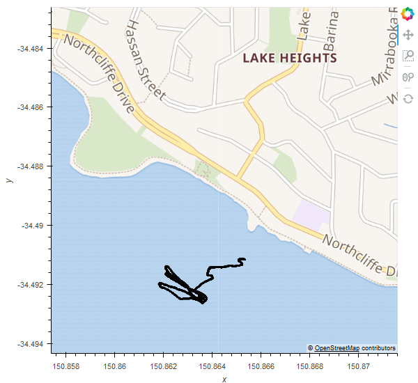
If I just use the area traveled by the sonar, then there is no context (just covers water in most cases and the map looks blue). When traveling close to the shore (as is common in this scenario), it would be good to extend the displayed map area to also include the nearest landmark (currently suburb center in my implementation) so at a glance people can see roughly where the traveled path is.
I am doing this at the moment using the overpass API and open-street-maps, however it is slow and flaky as the OSM servers rate limit requests and are often overloaded.
You can see two examples attached to this message, one without intelligent framing and the other with it (Not allowed two images so just showing the intelligent framed on, the other just shows blue water and path).
Is there any way to achieve what I want using holoviews instead of overpass?
It seems like a problem others would have solved before.
Thanks,
Brendon.