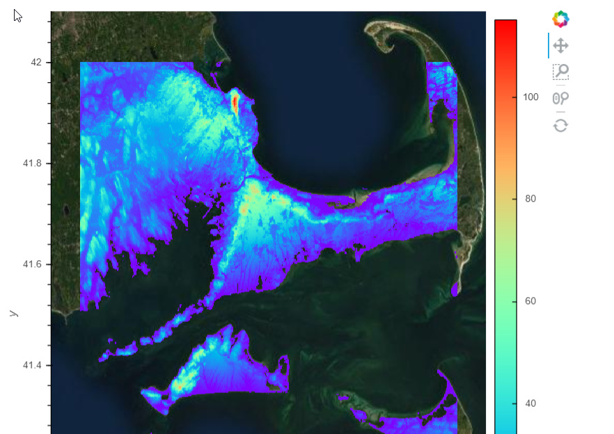
Here’s a simple notebook using hvPlot that demonstrates how to explore the USGS Terrain Data in COG format, available in a public AWS Bucket. The resolution is 1 arc second, or about 30m, and the data are stored in 1x1 degree squares that cover the US.
1 Like