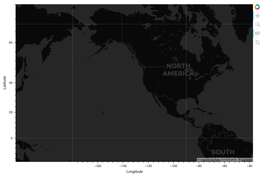
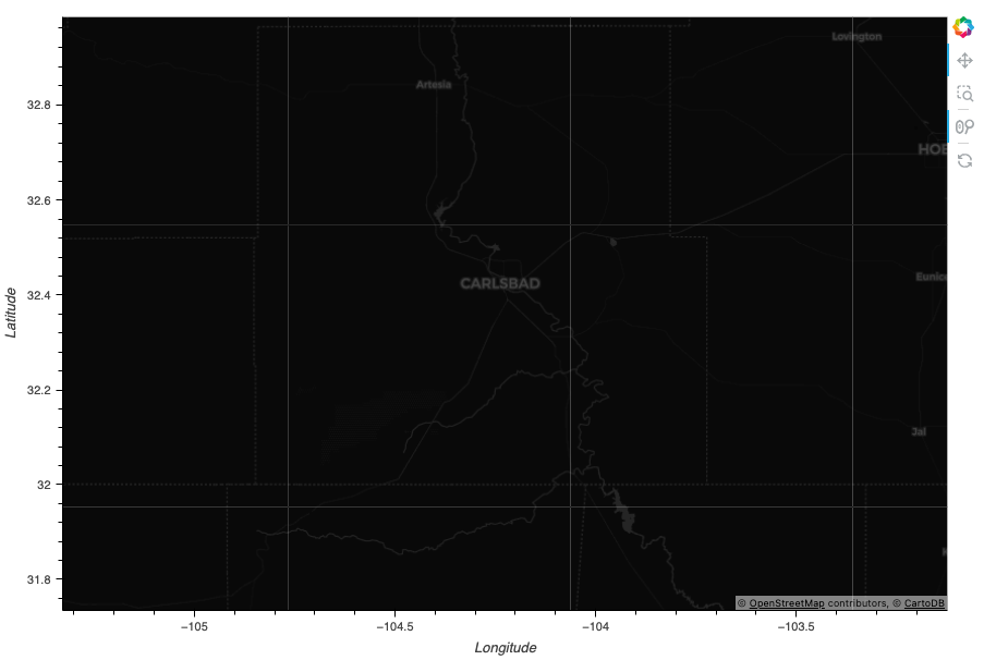
I can’t figure out why, but every WMTS layer in GeoViews shows white lines around the edges of the map tiles.
I see this issue in the examples in the GeoViews documentation, but it’s most obvious with the CartoDark basemap (see below). These gridlines get in the way and distract from other data on the plot. I can’t figure out what’s going on with this. I’ve tried my own custom WMTS layers that render fine in other geospatial mapping libraries like Leaflet.js.
Do other people see these gridlines? Or is this something weird going on in my browser?
import geoviews as gv
gv.tile_sources.CartoDark().opts(active_tools=['wheel_zoom'], width=900, height=600)