Hi everyone,
I am using a custom tiles server with gv.WMTS. The attribution seems to show when using the WMTSTileSource object from Bokeh or the built-in OSM tiles with gv.tile_sources.OSM() but it does not show with the custom tile server.
Minimal code to reproduce :
from bokeh.plotting import figure, show
from bokeh.io import output_notebook
from bokeh.models import WMTSTileSource
output_notebook()
import cartopy.crs as ccrs
import numpy as np
x_bounds=(2.14572, 2.61568)
y_bounds=(48.68763, 49.01233)
google_mercator_bbox = ccrs.GOOGLE_MERCATOR.transform_points(
ccrs.PlateCarree(), x=np.array(x_bounds), y=np.array(y_bounds)
)[:, :-1].flatten()
PLANIGNV2_tile_provider = WMTSTileSource(url="https://data.geopf.fr/tms/1.0.0/GEOGRAPHICALGRIDSYSTEMS.PLANIGNV2/{Z}/{X}/{Y}.png",
name='PLAN IGN',
attribution="""
<a href="https://geoservices.ign.fr/services-web-decouverte" target="_blank">© Institut national de l'information géographique et forestière
</a>""")
plan_ign_v2 = figure(x_range=(google_mercator_bbox[0], google_mercator_bbox[2]),
y_range=(google_mercator_bbox[1], google_mercator_bbox[3]),
min_width=800, min_height=400,
x_axis_type='mercator', y_axis_type='mercator',
active_drag='pan', active_scroll='wheel_zoom', match_aspect=True)
plan_ign_v2.add_tile(PLANIGNV2_tile_provider)
show(plan_ign_v2)
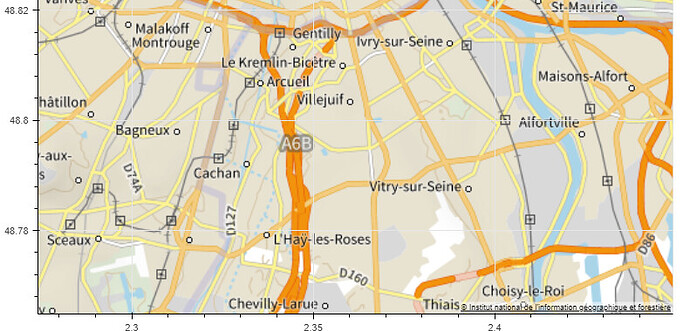
This shows the attribution at the bottom right corner of the map:
Then using it with Geoviews :
import geoviews as gv
gv.extension("bokeh")

gv.WMTS(PLANIGNV2_tile_provider).opts(active_tools=['wheel_zoom'], min_height=500, min_width=800, xlim=(google_mercator_bbox[0], google_mercator_bbox[2]), ylim=(google_mercator_bbox[1], google_mercator_bbox[3]))
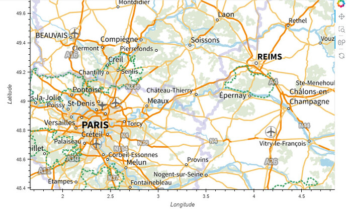
The tiles are showing but not the attribution:
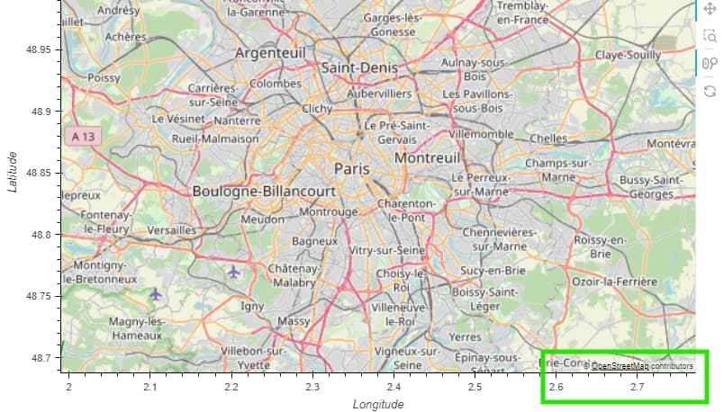
However, I checked with the built-in OSM tiles and the attributions are there:
gv.tile_sources.OSM().opts(active_tools=['wheel_zoom'], min_height=500, min_width=800,
                              xlim=(google_mercator_bbox[0], google_mercator_bbox[2]),
                     ylim=(google_mercator_bbox[1], google_mercator_bbox[3]))


